My Earthquake Alerts - Map
- 4.7
- Rating
- 10.00M
- Installs
- Free
- Price

 Analysis by App-foxy
When I install a weather app, I want it to answer one practical question quickly: is something happening near me, and is there a useful way to understand it? My Earthquake Alerts - Map takes a narrower approach than a general forecast app. It focuses on earthquakes, their locations, alerts, and map-based context rather than trying to become an all-purpose weather dashboard. After spending time with it, I found that focus both reassuring and limiting: it is easy to understand when I need earthquake information, but it is not a substitute for every kind of emergency or weather tool.
The app comes from JRustonApps B.V. and is available free of charge for everyone. It has built a substantial audience, with more than ten million installs, an average rating of 4.6 from roughly 233 thousand ratings, and about 6.3 thousand written reviews. Those figures suggest that the basic idea is landing well with many users, although popularity alone is not a reason to treat an alert as unquestionable. Earthquake information is time-sensitive, so I still regard the app as a convenient information layer rather than an official safety authority.
How the earthquake feed earns trust
The strongest part of the experience is its clear subject. Instead of burying seismic activity inside a crowded forecast screen, the app puts earthquakes and maps at the center. That makes it useful for someone who lives in an earthquake-prone area, travels frequently, follows activity near family members, or simply wants a direct way to check a tremor that has just been felt.
You May Also Like

 Blood Strike: 2.5 Anniversary
Blood Strike’s Loadouts Turn Every Drop Into a Tactical Gamble
A close look at Blood Strike’s custom loadouts: how fast access to signature weapons reshapes its battle royale rhythm, rewards preparation, and narrows the gap between fights.

 Pandora - Music & Podcasts
Pandora’s Music Is Easy to Start, but Harder to Recover
Pandora’s strength is its low-effort path from a seed to a station. Its weak spot is how much confidence it asks you to place in connection, setup, and quiet recovery.

 8 Ball Pool
 Is Built on Rivalries, Rematches, and Routine
A close look at the rivalries, rematches, shared routines, and unanswered safety questions that turn a quick pool match into a persistent mobile community.

 Samsung Music
’s Quiet Strength Is Playing What You Already Own
Its reach comes less from spectacle than from dependable access to a personal library. That simplicity is both the app’s strongest retention engine and its ceiling.

 AccuWeather: Weather Radar
AccuWeather Review: A Quick, Clear Forecast for Everyday Decisions
For everyday plans, the best forecast is the one you can understand quickly. AccuWeather makes rain timing, radar, and local conditions easy to act on, with a few trade-offs.

 Hill Climb Racing
Why Hill Climb Racing Still Turns Crashes Into One More Run
A tiny car, a bumpy hill and one more upgrade: Hill Climb Racing keeps resurfacing because its simple chaos makes every near-miss feel personal.
More From Our News Desk
View All News


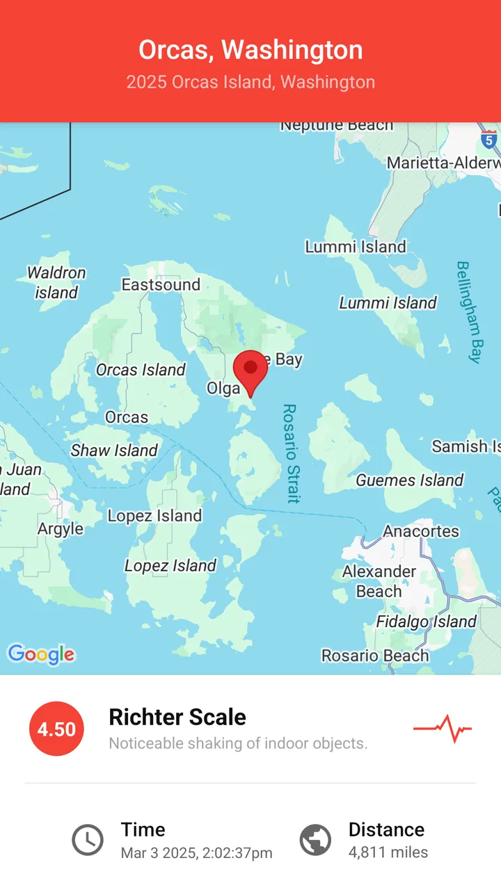
In everyday use, I would open it after feeling a brief shake, look at the recent activity, and compare the reported location with my own area. The map gives the event a geographic frame that a plain notification cannot provide. Even when an earthquake is not close enough to affect me, seeing where it occurred helps me distinguish a local event from something being discussed elsewhere.
The developer has kept the app’s identity straightforward. It is a weather-category app, but its subject is much more specific than rain, temperature, or wind. That specialization is important because it reduces the temptation to treat one screen as a complete picture of conditions around me. I would use a normal weather service for forecasts and this app when the question is specifically seismic activity.
There is also a useful trust habit here: I can treat the map as a way to investigate an event rather than relying only on a dramatic alert sound or a headline. Looking at location, timing, and nearby activity together gives me more context before I decide whether I need to check local authorities or contact someone. The app is most valuable when it helps me ask a better safety question, not when I let it make the safety decision for me.
That distinction matters because earthquake reporting can change as information is reviewed. An initial report may not tell the whole story, and an alert arriving quickly does not automatically mean every detail is final. I appreciate the speed-oriented design, but I would still verify serious situations through official emergency channels, especially if there is a possibility of tsunami, structural damage, fire, or continuing danger.
What I can do with the map in real situations
The map is more than decoration. It gives me a way to move from a vague notification to a location-based understanding. If a relative in another region says they felt shaking, I can use the geographic view to see whether the reported event appears near them or far away. If I am planning a trip, I can check recent activity in the destination area without confusing that information with a prediction of what will happen next.
A practical workflow is to check the alert, open the map, identify the event’s position, and then compare it with the place I care about. I would avoid repeatedly refreshing in a stressful moment, because that can create the feeling that I am monitoring a live command center when the app is really an information tool. A calmer approach is to use the app for orientation and then move to local guidance if the situation appears relevant.
Another non-obvious advantage is that the map can help reduce unnecessary alarm. A notification about an earthquake may sound important, but distance changes its meaning. An event shown well away from my home may be worth knowing about without being an immediate personal threat. Conversely, a nearby event deserves more attention even if the notification itself is brief. The visual context helps me make that first distinction.
The trade-off is that map-based information rewards users who are willing to interpret it. Someone looking for a simple sentence such as “nothing is happening near me” may find the experience less direct than a general emergency service. The app gives me a focused view of earthquake activity, but I still have to apply geography and common sense to understand what the event means for my circumstances.
Alerts are useful, but they should not become my only safeguard
Alerts are the feature most likely to bring people to the app, and they make sense for users who want to know about earthquakes without manually checking a feed. I like the idea of receiving a prompt and then choosing whether to investigate further. That sequence is less demanding than opening the map repeatedly throughout the day.
At the same time, I would not use an alert as proof that I have received the earliest possible warning or that every earthquake in every location will be represented in exactly the same way. Timing, network conditions, device settings, and the underlying reporting process can all affect how useful a notification feels in practice. The responsible setup is to keep the app as one source of awareness while maintaining the official emergency alerts and instructions relevant to where I live.
For a household, I would also discuss what an alert means before a stressful event occurs. The app can point me toward information, but it cannot replace a plan about where to move, how to contact family, or what to do if utilities or buildings are damaged. That is not a failure of this particular app; it is simply the boundary between an information feed and emergency preparedness.
Controls, privacy choices, and moments that deserve care
When I judge an app through a trust lens, I look first for clear user choices rather than assuming that a polished interface tells me everything. Here, the important questions are practical: which alerts do I want, how often do I want to be interrupted, and which device permissions or system settings am I comfortable enabling? I would review those choices during setup and again after an update instead of accepting every prompt automatically.
The app’s free price lowers the barrier to trying it, but free does not mean I should stop paying attention to data practices. I would read the privacy information presented in the app or its store page, check the permissions requested on my particular device, and decide whether the benefit of location-aware information justifies any access I am asked to provide. Permission names can vary between Android and iOS, so I would judge what appears on my own phone rather than relying on a generic checklist.
This is especially important for location. A map can be useful without me treating it as a reason to share more precise information than necessary. If the operating system offers a choice between approximate and precise location, I would select the least detailed option that still supports the way I intend to use the app. If I only want worldwide earthquake browsing, I would be cautious about granting continuous location access simply out of habit.
Notifications deserve the same attention. I would allow alerts if timely earthquake awareness is the main reason I installed the app, but I would not leave every category enabled without considering how I react to frequent interruptions. A notification that is useful during the day can become easy to ignore if too many unrelated messages compete for attention. Reviewing notification controls is therefore part of making the app trustworthy for me, not an afterthought.
I also prefer to keep account decisions deliberate. If the app offers any sign-in or personalization prompt, I would use only the controls I actually need and avoid sharing extra information merely to explore the map. I would check whether an account is necessary for the functions I care about, and I would look for ways to manage or remove saved information if I stop using the service. Those are sensible habits for any app handling alerts or location-related preferences.
One limitation of this kind of review is that permissions and choices can differ by platform, operating-system release, region, and app version. The current version is 26.1.2, and the app supports Android from version 7.0 onward, but the screen I see can still depend on my device and settings. I would therefore treat the permission panel shown on my phone as the final word before enabling access. Trust comes from checking the choices in front of me, not from assuming that every installation behaves identically.
Where the app fits beside ordinary weather and emergency tools
Compared with a standard weather app, this one is more focused and less cluttered for earthquake monitoring. A general forecast service may show warnings alongside rain, heat, wind, and air quality, but earthquake information can become just one tile among many. Here, the subject is central, which makes it faster to use when I already know what I am looking for.
Compared with official emergency alert systems, however, I would give the official channel priority for instructions and urgent public safety messages. An earthquake feed can help me understand an event and notice activity, while authorities are the better source for evacuation orders, road closures, tsunami guidance, shelter information, and local instructions. I see the two tools as complementary rather than interchangeable.
Compared with manually searching the web, the app is more convenient for repeated checking because the map and alerts keep the information in one place. Search is still valuable when I need confirmation from a government agency, a local news service, or a specialist source. My preferred combination would be the app for quick awareness, official sources for decisions, and a normal weather app for broader daily conditions.
The app is a particularly good fit for people who want a worldwide view rather than information limited to one neighborhood. Travelers may use it to understand activity around a destination, while families spread across different regions may find the map helpful when checking on one another. It also suits users who prefer visual context and do not want to depend entirely on text notifications.
I would skip it if I want a complete climate, forecast, radar, or severe-weather package. I would also skip relying on it alone if my main need is a formal emergency communication system. Someone who finds maps confusing or who becomes anxious from monitoring every seismic report may be better served by enabling only official alerts and checking earthquake information when there is a specific reason.
Small habits that make the experience more useful
My first tip is to decide what “near me” means before an event happens. A report can be geographically close yet have little practical effect, while a more distant event may matter because of local conditions or secondary hazards. I would use the map to establish context, not to create a rigid personal danger line.
My second tip is to separate checking from reacting. When an alert arrives, I would read it, inspect the map, and then look for official guidance if the event could affect me. That simple sequence prevents the app from becoming a source of impulsive conclusions. It also makes the information easier to explain to another person who may be worried.
My third tip is to test notification behavior during a calm period. I would review whether alerts appear as expected, confirm that the phone is not silencing them through a focus or battery mode, and make sure I understand the app’s notification controls. This is more useful than discovering during a real event that the operating system has restricted background activity or muted the channel.
My fourth tip is to protect attention as well as privacy. If worldwide activity creates too many notifications, I would narrow the choices available in the app or at the operating-system level rather than abandoning the service immediately. A focused alert stream is more likely to remain useful than a constant stream that I learn to dismiss automatically.
Finally, I would keep the app updated through the normal store process and revisit permissions after major changes. Updates can alter screens and controls, while operating-system upgrades can change how location and notifications work. I would consider that maintenance part of responsible use, particularly because the app’s value depends on alerts reaching me when I expect them.
My cautious verdict
My Earthquake Alerts - Map is a focused, approachable choice for people who want earthquake activity, alerts, and map context in one dedicated app. I like that it does not pretend to be a complete forecast service, and I find the geographic view more informative than a bare notification. Its free availability and Everyone content rating also make it easy to try without turning the decision into a major commitment.
My recommendation comes with a clear condition: use it as an awareness and exploration tool, not as the sole foundation of an emergency plan. Check the permissions and notification choices on your own device, share only the access you are comfortable with, and confirm serious situations through official local sources. The app is at its best when it gives me a fast starting point and enough context to decide what to check next.
After using it, I would recommend it to a friend who follows seismic activity, lives in a region where earthquakes are a realistic concern, or wants a convenient way to check events affecting people elsewhere. I would not recommend replacing official alerts, local instructions, or a broader weather app with it. For focused earthquake awareness, it is a sensible companion; for complete safety information, it should remain one carefully chosen part of a larger setup.
FAQs for My Earthquake Alerts - Map
01What features does My Earthquake Alerts - Map offer?
My Earthquake Alerts - Map provides real-time notifications of earthquakes worldwide, along with a detailed map displaying recent seismic activity. Users can customize alerts based on magnitude and distance. The app also includes historical earthquake data and user-friendly filters to sort through events by region or severity.
02How accurate is the earthquake data provided by the app?
The app sources its data from reputable seismic networks and organizations, ensuring high accuracy and reliability. It updates in real-time to provide users with the latest information on earthquake occurrences, allowing for timely alerts and an accurate depiction of global seismic activity.
03Is My Earthquake Alerts - Map free to use?
Yes, the basic version of My Earthquake Alerts - Map is free and offers essential features such as real-time alerts and access to earthquake data. However, there may be in-app purchases or a premium version available that provides additional features like advanced customization and ad-free experience.
04Can I customize the alerts I receive in the app?
Absolutely, users have the flexibility to customize their alerts based on specific criteria such as magnitude, location, and notification preferences. This customization ensures that users receive only the most relevant updates, reducing unnecessary notifications and focusing on events that matter to them.
05How user-friendly is the interface of My Earthquake Alerts - Map?
The app boasts a clean and intuitive interface designed for ease of use. Users can easily navigate through maps, filter earthquake events, and access detailed information with minimal effort. The simplicity and efficiency of the design make it accessible to both tech-savvy individuals and those less familiar with mobile technology.
Pros
- Real-time earthquake notifications.
- Customizable alert settings.
- Global earthquake coverage.
- User-friendly interface.
- Detailed seismic data available.
Cons
- Ads can be intrusive.
- Limited offline functionality.
- No widget support for quick access.
- Some features require in-app purchases.
- Occasional notification delays.

My Earthquake Alerts - Map
Gallery